“Who else has data from our territory?” Working with the Wayana on biodiversity data
“Who else has data from our territory?” Working with the Wayana on biodiversity data
By Rudo Kemper, Director of the Indigenous Guardianship Program at Conservation Metrics
Sometimes a very specific question from a partner organization opens up a much bigger area of work.
That happened this week with the Mulokot Foundation in Suriname. What started as a conversation about iNaturalist turned into a broader exploration of biodiversity data from the Wayana Territory: where it goes, who holds it, who has collected it, and how communities can have greater visibility and control over it.
It also became a good example of how we work at Conservation Metrics: a combination of advisory support, hands-on technical accompaniment, and tool building, all emerging from concrete partner needs.
From iNaturalist to Guardian Connector
The Mulokot Foundation works with the Wayana community in Suriname to support Indigenous-led stewardship, cultural continuity, and monitoring of the Wayana Territory. Its biocultural monitoring system tracks wellbeing from an Indigenous Wayana perspective. As part of that work, Mulokot has been using iNaturalist to collect biodiversity observations in the territory and plans to continue using it during an upcoming citizen science expedition in October with Echo Echo & Taxon Expeditions, a Dutch research institute. iNaturalist is a global platform where people can record, identify, and share observations of plants, animals, and other species.
We had been talking with Mulokot about the implications of using a platform like iNaturalist from a data sovereignty perspective. In this case, they were comfortable with these particular observations being public because the species they were documenting were not considered sensitive.
While looking through the data together, we noticed that some of the observations had also appeared on GBIF, the Global Biodiversity Information Facility. So we started digging into how that happens.
We found that licensing is part of the answer. Research-grade observations on iNaturalist can be incorporated into GBIF when they are published under compatible licenses. That led us into a useful discussion about the relationship between the two platforms, and how a decision made when publishing data in one place can affect where that data ends up later.
Conservation Metrics has already recently built an iNaturalist connector for Guardian Connector, our private data integration and monitoring platform co-created together with Nia Tero, who is also a key funder of the platform, and over a dozen of its Indigenous community organizations across the world.
We pulled Mulokot’s iNaturalist observations into their own Guardian Connector data warehouse and set it up so that new observations will continue to sync automatically. But going through the data also showed us something we needed to improve. We realized that we were not pulling in the metadata that says whether an iNaturalist observation has reached “Research Grade” status. Given that this status matters for how observations can move into GBIF, that was clearly something the connector should include.
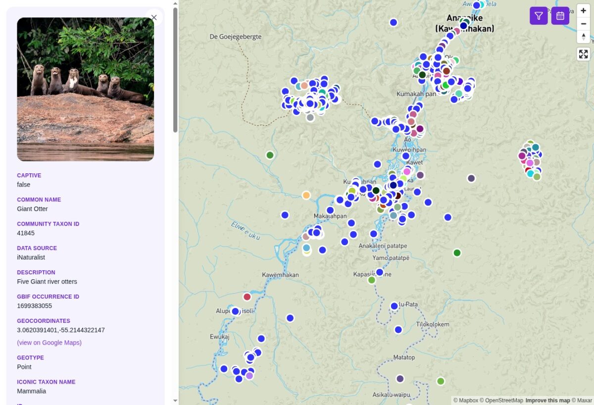
INaturalist data from across Wayana territory, stored and visualized in Mulokot’s Guardian Connector.
So even at that stage, the work was doing two things at once: helping Mulokot bring their data into their own infrastructure, while also showing us how the Guardian Connector integration itself needed to improve.
Then the GBIF discovery led to a bigger question.
“Who else has our data?” Enter GBIF
Mulokot’s slogan is “Nothing About Us, Without Us.” That made the next question in relation to this work pretty obvious:
What other biodiversity data from the Wayana territory is already out there?
Who has collected data there? What species were they documenting? Which institutions hold those records? How old are they? Are they attributing the Wayana as knowledge holders, at all?
We tried to answer that through the existing GBIF interface, but it was not especially easy to get a clear territory-level picture. So we built a small tool to make it easier.
The result is the GBIF Map Search tool, here you can upload a territory boundary or define an area on a map and search GBIF for biodiversity records that fall inside it. It returns information on datasets, publishers, species, records, and collection dates.
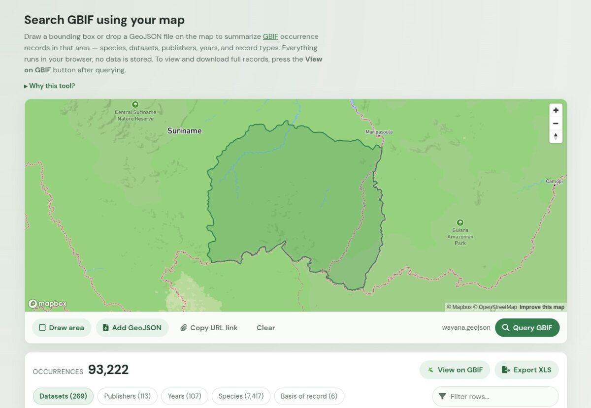
Wayana territorial boundary used to query GBIF
When we searched the Wayana Territory, the scale and variety of what came back was striking. There were more than 90,000 biodiversity records published by dozens of institutions around the world, with records reaching back to 1842. The data included observations and specimens of grey-winged trumpeters, collared peccaries, toucans, black curassows, spider monkeys, red howler monkeys, capuchins, agoutis, macaws, caimans, tortoises, and many other species.
The records also reflected many different kinds of biodiversity research conducted in the region over time, including bird observations, museum specimens, herbarium collections, fish records, fungi, insects, soil eDNA, genetic barcodes, expedition collections, and bird sounds. The data is distributed across institutions such as the Smithsonian, Cornell Lab of Ornithology, Missouri Botanical Garden, Royal Botanic Gardens Kew, Naturalis Biodiversity Center, and research institutions in Suriname, Europe, and the Americas.
Seen together, those records reveal a long history of biodiversity research in and around the Wayana Territory that has been distributed across collections and databases around the world. For Mulokot, that opens up important questions about what has been documented, by whom, where those records now live, and whether the Wayana are represented in the information collected from their territory.
Turning one partner question into something reusable
Abram Fleishman, Director of Conservation Metrics’ Science program, and I started thinking that this was unlikely to be a question unique to Mulokot. Many community organizations may want to know what biodiversity information has already been collected from their territories, particularly when thinking through questions of data governance, research relationships, culturally sensitive species, or future monitoring work.
So, we looked into how the underlying GBIF records could be downloaded, and our new lead software engineer Brendan McGill added a connector script to our growing library of data connectors. The connector allows GBIF records from within a defined territory to be pulled directly into Guardian Connector, giving Mulokot a way to access and analyze biodiversity data from across the Wayana Territory within their own system.
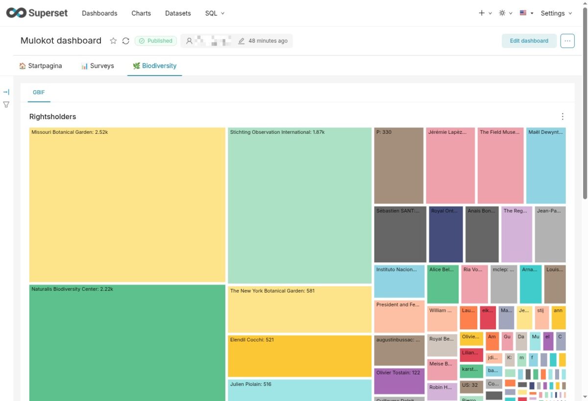
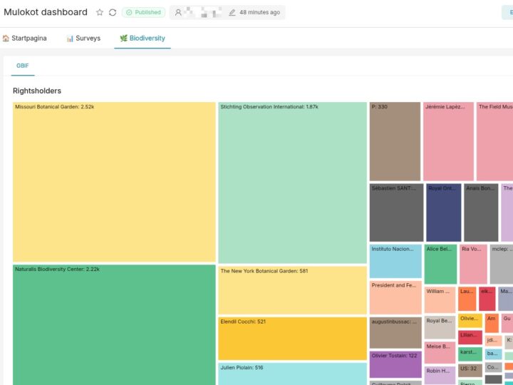
GBIF data analyzed on Mulokot’s Guardian Connector dashboard, showing the rightsholders of more than 90,000 biodiversity occurrences
We also realized that a lot of what we were learning about iNaturalist and GBIF was not especially obvious if you do not work with these systems regularly. There are questions around Research Grade status, licenses, what gets shared downstream, and how records can be accessed again later.
Therefore, we documented what we learned. The Guardian Connector documentation hub is an important part of making these tools and processes more accessible to Indigenous and community partners, bringing together practical training materials with guidance on more nuanced issues such as data governance, ownership, and sovereignty. We published two new guides here: one on community use of iNaturalist and another on GBIF. They cover how the platforms work, some of the considerations for Indigenous and community organizations using them, how data moves between systems, and how data can be accessed or exported. The GBIF guide also links to the map search tool.
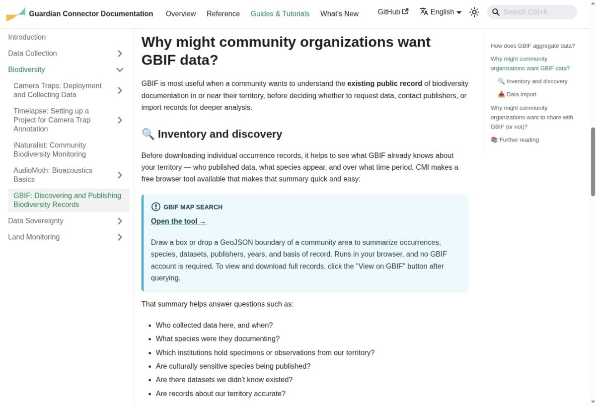
Guide on Guardian Connector documentation about Indigenous community use cases for GBIF
Within a few days, one conversation with Mulokot had turned into several different pieces of work: support to Mulokot around how their biodiversity data is being shared, an improvement to the Guardian Connector iNaturalist integration, a new GBIF territory search tool, and two guides that can now be used by other organizations.
This is exemplary of how we think about scaling and replicating our work. We are not trying to solve the same problem separately for every organization. A partner comes to us with a particular question or need. We work through it with them; and, if part of what we learn can be turned into a better integration, a reusable tool, or documentation that helps the next organization, we do that too.
Supporting communities to decide how their data travels
There is one more piece we are now looking at. We want communities using Guardian Connector to be able to take biodiversity data in their own systems and export it using Darwin Core, the widely used data standard for exchanging biodiversity information. To support this process, we have already integrated with Local Contexts, an initiative that provides customizable Traditional Knowledge and Biocultural Labels that communities can use to communicate their own protocols, expectations, and rights around the use of data and knowledge.
For Mulokot, the ability to build and maintain this body of data under their own control has particular significance. Suriname remains the only country in South America that does not legally recognize Indigenous Peoples’ collective rights to their lands and territories. Building a record of biodiversity, monitoring, and stewardship in the Wayana Territory can help Mulokot document their ongoing guardianship of the territory and support their own efforts to advocate for recognition of their collective territorial rights.
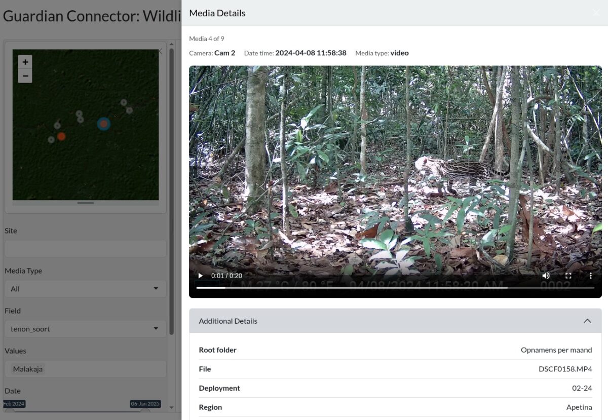
Camera trap data collected by Mulokot shown in a new Guardian Connector interface designed for biodiversity data, originally co-created with the Chepkitale Indigenous Peoples’ Development Project in Kenya
For Mulokot and other community-based organizations, that could mean keeping and organizing biodiversity observations inside infrastructure they control, while still being able to export those records in a format that can be shared with researchers, biodiversity databases, or other systems if they decide to do so. That part matters because the goal is not to keep biodiversity data from ever being shared. It is to make sure communities know where their data travels, retain a copy within systems they control, and are the ones deciding when, how, and with whom it is shared.
A few days earlier, we had simply been looking at Mulokot’s iNaturalist observations together. Seeing some of those same observations appear in GBIF raised a question about where else the data was traveling. That, in turn, led us to ask what other biodiversity information had already been collected from the Wayana Territory, who held it, and how Mulokot might bring some of that history back into infrastructure they control.
It is a much bigger set of questions than where we started, but that is often how this work develops: following a partner’s questions far enough to understand what sits behind them, and then figuring out what we can build together in response.
Conservation Metrics works in partnership with the Mulokot Foundation via support from the Nia Tero Foundation. Conservation Metrics’ work to integrate biodiversity data with Guardian Connector is also supported by the 11th Hour Project, a program from the Schmidt Family Foundation.